
Sidina
High-grade intrusive related gold veins
The Sidina Property has been optioned.
The Sidina Property is located 22 kilometres northeast of Hazelton, British Columbia in the Omineca Mining Division. The property was explored for vein type gold mineralization by Noranda in 1987 and 1988.
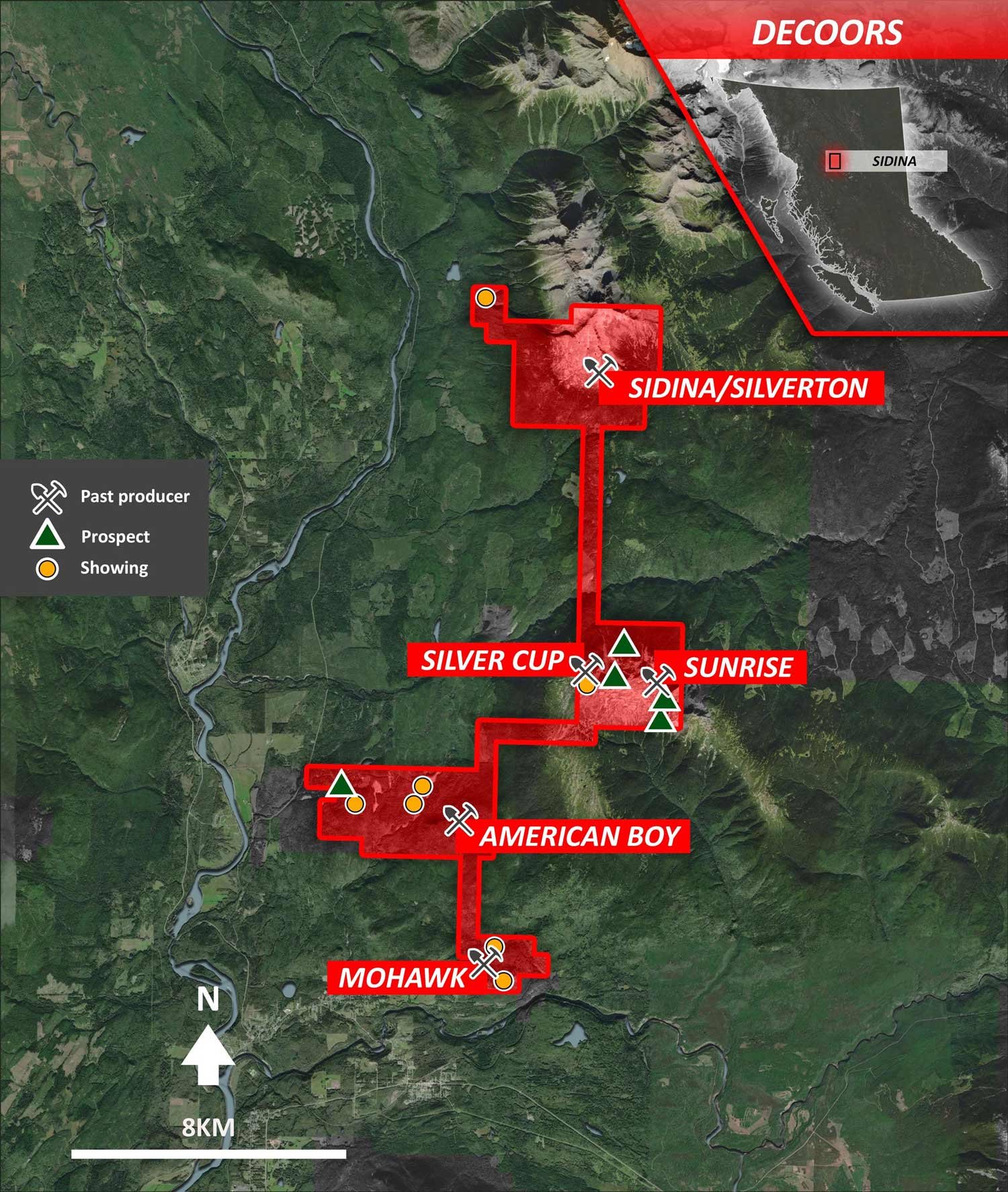
Sidina Location Map
Mineralization consisting of gold, silver, copper, lead, and zinc-bearing sulphides are associated with late-stage quartz veining in fault/fissure/shear zones resulting in multiple, sub-parallel veins. The veins appear to be persistent over considerable strike lengths (>100 meters). The veins are hosted by Cretaceous Bulkley Plutonic Suite (monzonite, quartz monzonite to granite), and extend into the surrounding country rock that consists of hornfels sediments of Middle Jurassic-Late Cretaceous Bowser-Skeena Group. Veins trend west-northwest and northwest (dipping shallow to moderate north) whereas the regional faults trend northeast and are steeply dipping, suggesting the quartz-sulphide veins are tensional (or dilational) pull-apart structures and late-stage infilling of residual metal-enriched hydrothermal fluids.
The mineralization observed to date has two mineralogical characteristics that impact the precious metal grades:
1) mineralization dominated by arsenopyrite-pyrite banded intergrowths and
2) mineralization dominated by banded arsenopyrite with minor pyrite-galenasphalerite-tetrahedrite at the vein margins.
Locally, the veins carry small amounts of copper sulphides that include tetrahedrite. This mineral association is of particular significance as it produces the highest gold grades - reaching up to 52.48 g/t gold.
Gold mineralization on the property conforms to a broadly defined intrusion related class of deposits. The distinctive feature of this class of gold deposits are sheeted arrays of parallel, single-stage quartz veins which are found over 10s to 100s of metres and preferentially located in the pluton’s cupola. These types of veins are also described as the “reduced intrusion-related gold systems” represented by Fort Knox, Pogo, Donlin Creek, and Dublin Gulch deposits in Alaska and the Yukon.
There are a minimum of nine narrow, shallow dipping, quartz-sulphide veins present over the “Camp Area” which to date measures 130 x 150 metres. The area has minimal rock exposure although the depth to bedrock is relatively shallow. Oxidized quartz-sulphide float is present in numerous locations and extends beyond the areas sampled. A 2009 soil survey outlined a weak gold-in-soil anomaly extending to the south of the Camp Area. The anomaly is enhanced by the presence of copper-in-soils which in turn is indicative of sulphide dispersion. The multi-element anomalies in the same area include arsenic, lead, and zinc.